26th March
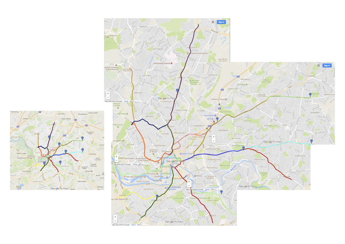
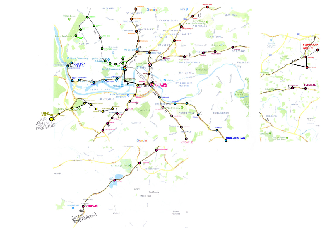
This is an image of the original tram network imposed onto Google maps. There were 17 in total and not all are visible here as some overlay others.
This is an image of the original tram network imposed onto Google maps. There were 17 in total and not all are visible here as some overlay others.
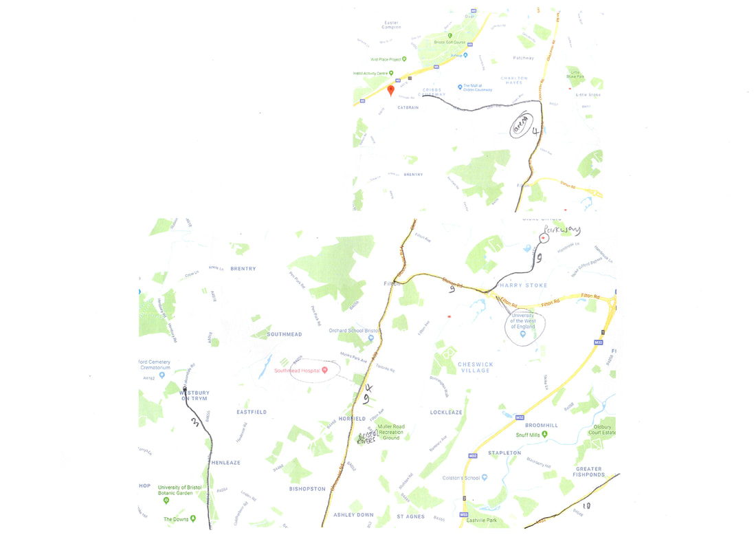
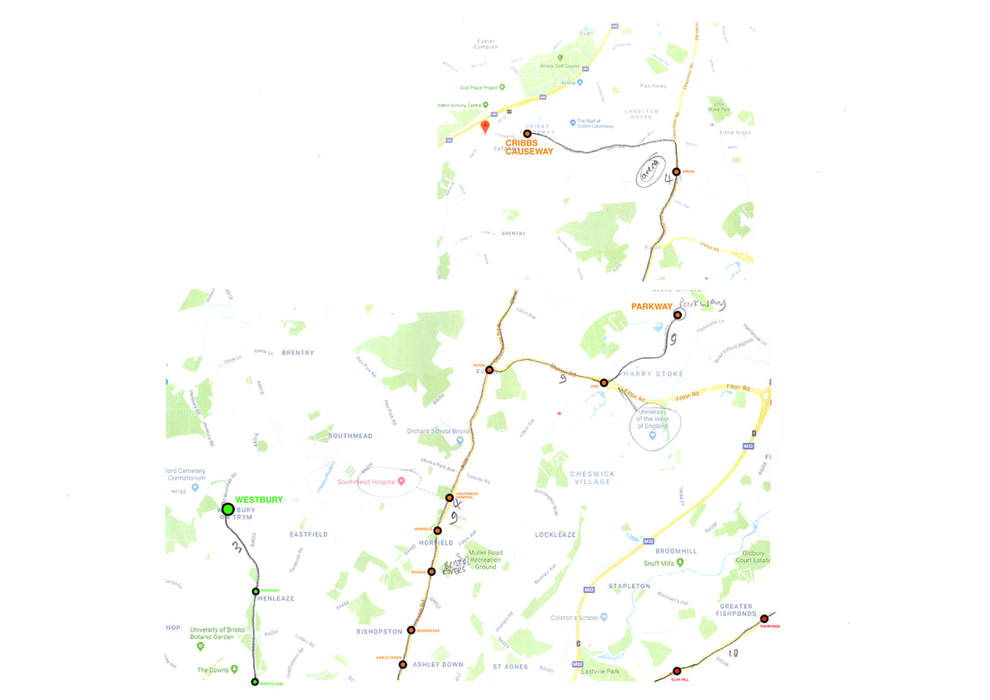
I printed a map of Bristol and sketched where I would like my tram lines to be. I tried to keep them as close to the original network as possible but included areas that would be useful today, such as the airport, Long Ashton park & Ride for the football crowds at Ashton Gate, Cribbs Causeway, UWE and Filton, should an arena eventually be built there. To keep the project straightforward, I kept it to 10 lines with little overlapping. The furnicular railway is included in the network and the line numbers are for my reference only at this stage.
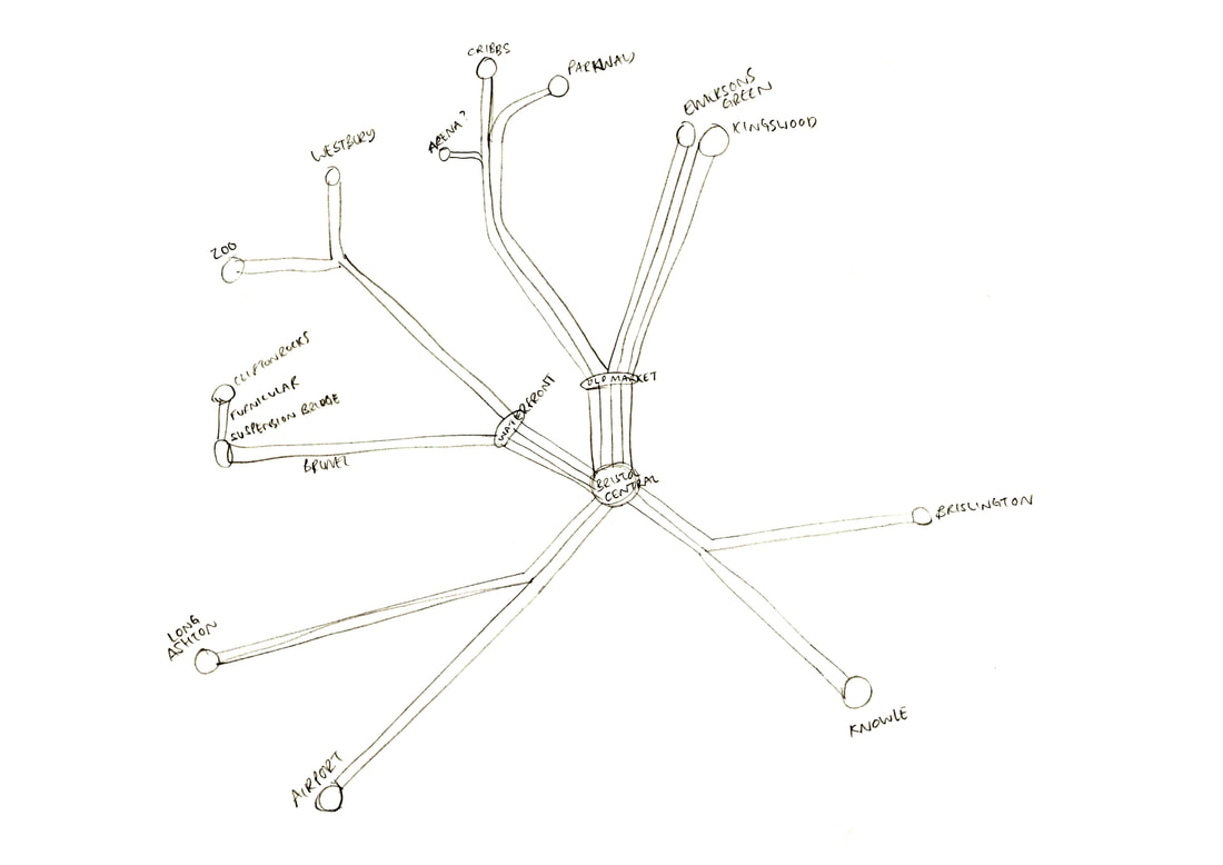
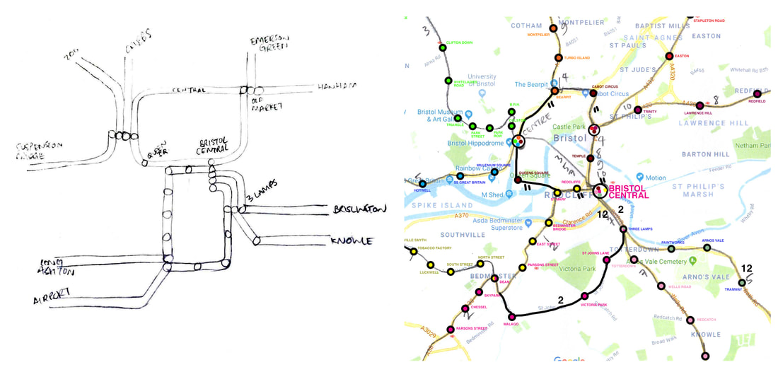
This is a simplified sketch of the network which I will use to turn into an easy to use map. It would perhaps be useful to try and connect the Waterfront and Old Market stations with an existing line or an additional line that is restricted to the centre with Bristol Central incuded too.
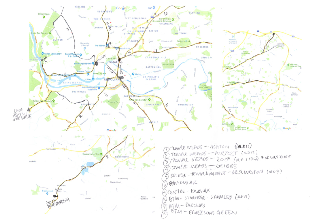
I added the individual stop names onto the map, changing a couple of routes and adding a central line. The furnicular has been incorporated into the Suspension Bridge line so I still have a total of 10 lines. The names reflect the areas they are in and only include Bristol's main places so as not to overcomplicate the project. This should give me enough to work with to make the final map and also have a good resemblance to the city in reality.
I tried to draw the map but realised I needed to adapt the lines to make it work better. I broke up the line running from the Suspension Bridge, going through Bristol Central to Brislington, replacing it with a new line from Bristol Central to Brislington. This also means each line is singular from one of the 3 city centre main stops.
26th April
Following advice from Penny on choosing a typeface for my network map, I posted 4 choices on Facebook to get feedback from a variety of diiferent people. I made notes on the results:
Following advice from Penny on choosing a typeface for my network map, I posted 4 choices on Facebook to get feedback from a variety of diiferent people. I made notes on the results:
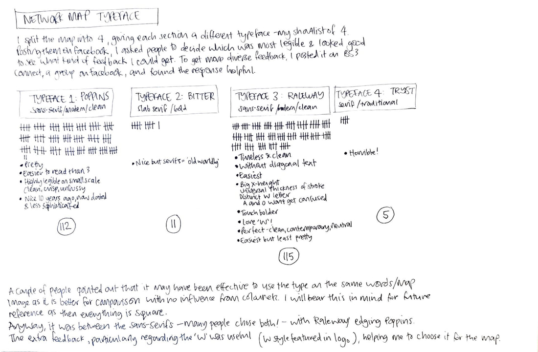
It is hard to see in this example but this is my network map with Raleway type and logo. The names of the lines are on the right.
